


ROGNOLET

oliviergau
User
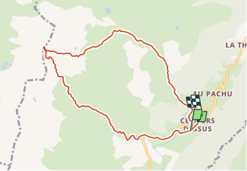

Length
9.5 km

Max alt
2570 m

Uphill gradient
1184 m
Km-Effort
25 km

Min alt
1348 m

Downhill gradient
1212 m
Boucle
No
Creation date :
2019-05-18 17:18:33.465
Updated on :
2019-05-18 17:18:33.465
--
Difficulty : Unknown

FREE GPS app for hiking
 SityTrail
IGN / Geographical institutes
SityTrail Plus
The world is yours!
About
Trail Touring skiing of 9.5 km to be discovered at Auvergne-Rhône-Alpes, Savoy, La Léchère. This trail is proposed by oliviergau.
Positioning
Country:
France
Region :
Auvergne-Rhône-Alpes
Department/Province :
Savoy
Municipality :
La Léchère
Location:
Celliers
Start:(Dec)
Start:(UTM)
297733 ; 5038531 (32T) N.
Comments